پرش به محتوا

فهرست میراث جهانی در جنوب شرق آسیا

از ویکی‌پدیا، دانشنامهٔ آزاد

فهرست میراث جهانی درجنوب شرق آسیا شامل ۳۱ میراث جهانی در هفت تایلند، لائوس، کامبوج، ویتنام، مالزی، فیلیپین و اندونزی می‌شود. چهار کشور میانمار، برونئی، سنگاپور و تیمور شرقی نیز در این منطقه قرار دارند که هیچ گونه میراث ثبت شده‌ای ندارند.[۱][۲]

اندونزی و ویتنام هر کدام با هفت میراث بیشترین میراث ثبت شده در این منطقه را دارند.[۳] میراث‌های اندونزی و تایلند نخستین میراث ثبت شده در این منطقه است.[۴] از ۳۱ میراث ثبت شده ۱۹ میراث فرهنگی و ۱۲ میراث طبیعی و دو میراث در خطر است.[۳]

شرح

[ویرایش]
نمایش مختصات در نقشهٔ: اوپن‌استریت‌مپ 
بارگیری مختصات: KML
نام: توسط کمیته میراث جهانی فهرست شده‌اند[۵]
مکان: شهر٬ استان یا نام کشور، با مختصات[nb ۱]
معیارها: ذکرشده برای میراث
مساحت: بر پایه هکتار
سال: سالی که در فهرست میراث جهانی ثبت شده‌است.
خطر: سال قرارگرفتن فهرست میراث جهانی در معرض خطر
دلیل: تهدید مورد نظر

فهرست میراث

[ویرایش]
  † در خطر
منطقه تصویر موقعیت معیارها مساحت
هکتار (جریب)
سال توضیحات منابع
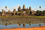
انگکور Ruins of a large structure with five large towers at the top. Siem Reap Province,  کامبوج
۱۳°۲۶′ شمالی ۱۰۳°۵۰′ شرقی / ۱۳٫۴۳۳°شمالی ۱۰۳٫۸۳۳°شرقی / 13.433; 103.833 (Angkor)
فرهنگی:
(i), (ii), (iii), (iv)
۱۹۹۲ The site had been listed as فهرست میراث جهانی در معرض خطر from its inscription in times of political instability following the civil war in the 1980s to 2004. [۶][۷]
[۸]
Ban Chiang Archaeological Site
Vase with red and white design.
اودون تانی،  تایلند
۱۷°۳۲′۵۵″ شمالی ۱۰۳°۴۷′۲۳″ شرقی / ۱۷٫۵۴۸۶۱°شمالی ۱۰۳٫۷۸۹۷۲°شرقی / 17.54861; 103.78972 (Ban Chiang Archaeological Site)
فرهنگی:
(iii)
۶۴ (۱۶۰) ۱۹۹۲ [۹]
کلیساهای باروک (فیلیپین) Interior of a church with white walls and coffered ceiling. مانیل; Santa Maria, ایلوکوس جنوبی; Paoay, ایلوکوس شمالی and Miag-ao, ایلوئیلو;  فیلیپین
۱۴°۳۵′۲۴″ شمالی ۱۲۰°۵۸′۱۲″ شرقی / ۱۴٫۵۹۰۰۰°شمالی ۱۲۰٫۹۷۰۰۰°شرقی / 14.59000; 120.97000 (Baroque Churches of the Philippines)
فرهنگی:
(ii), (iv)
۱۹۹۳ [۱۰]
Borobudur Temple Compounds A terraced pyramid like structure with a stupa on top. Magelang Regency, جاوه مرکزی  اندونزی
۷°۳۶′۲۸″ جنوبی ۱۱۰°۱۲′۱۳″ شرقی / ۷٫۶۰۷۷۸°جنوبی ۱۱۰٫۲۰۳۶۱°شرقی / -7.60778; 110.20361 (Borobudur Temple Compounds)
فرهنگی:
(i), (ii), (vi)
۱۹۹۱ [۱۱]
Central Sector of the Imperial Citadel of Thang Long - Hanoi
Stone tower on top of a stone wall. The wall has circular wheel-shaped windows and a red flag with yellow star is raised on top of the tower.
هانوی،  ویتنام
۲۱°۲′۲۲″ شمالی ۱۰۵°۵۰′۱۴″ شرقی / ۲۱٫۰۳۹۴۴°شمالی ۱۰۵٫۸۳۷۲۲°شرقی / 21.03944; 105.83722 (Central Sector of the Imperial Citadel of Thang Long - Hanoi)
فرهنگی:
(ii), (iii), (vi)
۱۸ (۴۴); buffer zone ۱۰۸ (۲۷۰) ۲۰۱۰ [۱۲]
قلعه خاندان هو A gate built of massive grey stones. Tây Giai, Vĩnh Lộc district, تان هوا،  ویتنام
۲۰°۴′۴۱″ شمالی ۱۰۵°۳۶′۱۷″ شرقی / ۲۰٫۰۷۸۰۶°شمالی ۱۰۵٫۶۰۴۷۲°شرقی / 20.07806; 105.60472 (Citadel of the Ho Dynasty)
فرهنگی:
(ii), (iv)
۱۵۶ (۳۹۰); buffer zone ۵٬۰۷۹ (۱۲٬۵۵۰) ۲۰۱۱ [۱۳]
هوء Staircase leading to a building of dark stone. A simple decorated gate is at the top of the staircase. استان توا تین–هوئه،  ویتنام
۱۶°۲۸′۱۰″ شمالی ۱۰۷°۳۴′۴۰″ شرقی / ۱۶٫۴۶۹۴۴°شمالی ۱۰۷٫۵۷۷۷۸°شرقی / 16.46944; 107.57778 (Complex of Hué Monuments)
فرهنگی:
(iii), (iv)
۱۹۹۳ [۱۴]
Dong Phayayen-پارک ملی خوا یای Forest Complex
Medium sized waterfall in a tropical forest.
سارابوری، ناکون راتچاسیما، ناخون نایوک، پراچینبوری، سا کایو and بوری رامs  تایلند
۱۴°۲۰′ شمالی ۱۰۲°۳′ شرقی / ۱۴٫۳۳۳°شمالی ۱۰۲٫۰۵۰°شرقی / 14.333; 102.050 (Dong Phayayen-Khao Yai Forest Complex)
طبیعی:
(x)
۶۱۵٬۵۰۰ (۱٬۵۲۱٬۰۰۰) ۲۰۰۵ [۱۵]
Gunung Mulu National Park Sunset or sunrise over a mountain landscape with fog in the valleys. northern ساراواک، بورنئو،  مالزی
۴°۸′ شمالی ۱۱۴°۵۵′ شرقی / ۴٫۱۳۳°شمالی ۱۱۴٫۹۱۷°شرقی / 4.133; 114.917 (Gunung Mulu National Park)
طبیعی:
(vii), (viii), (ix), (x)
۵۲٬۸۶۴ (۱۳۰٬۶۳۰) ۲۰۰۰ [۱۶]
خلیج‌ها لونگ Forested rocks in the sea. استان کوانگ نین،  ویتنام
۲۰°۵۴′ شمالی ۱۰۷°۶′ شرقی / ۲۰٫۹۰۰°شمالی ۱۰۷٫۱۰۰°شرقی / 20.900; 107.100 (Ha Long Bay)
طبیعی:
(vii), (viii)
۱۵۰٬۰۰۰ (۳۷۰٬۰۰۰) ۱۹۹۴[nb ۲] [۱۷]
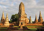
پارک تاریخی آیوتایا Ruins of stupas of various sizes. آیوتتایا،  تایلند
۱۴°۲۰′۵۲″ شمالی ۱۰۰°۳۳′۳۸″ شرقی / ۱۴٫۳۴۷۷۸°شمالی ۱۰۰٫۵۶۰۵۶°شرقی / 14.34778; 100.56056 (Historic City of Ayutthaya)
فرهنگی:
(iii)
۲۸۹ (۷۱۰) ۱۹۹۱ [۱۸]
شهرستان تاریخی ساکهاتایی
Large white seated Buddha statue.
Sukhothai and کامفائنگ فتs,  تایلند
۱۷°۰′۲۶″ شمالی ۹۹°۴۷′۲۳″ شرقی / ۱۷٫۰۰۷۲۲°شمالی ۹۹٫۷۸۹۷۲°شرقی / 17.00722; 99.78972 (Historic Town of Sukhothai and Associated Historic Towns)
فرهنگی:
(i), (iii)
۱۱٬۸۵۲ (۲۹٬۲۹۰) ۱۹۹۱ [۱۹]
ویگان (فیلیپین) ایلوکوس جنوبی،  فیلیپین
۱۷°۳۴′۳۰″ شمالی ۱۲۰°۲۳′۱۵″ شرقی / ۱۷٫۵۷۵۰۰°شمالی ۱۲۰٫۳۸۷۵۰°شرقی / 17.57500; 120.38750 (Historic Town of Vigan)
فرهنگی:
(ii), (iv)
۱۹۹۹ [۲۰]
Hoi An Ancient Town Street lined by rows of two-storied stone houses opening onto the street. Hoi An, استان کوانگ نام،  ویتنام
۱۵°۵۳′۰″ شمالی ۱۰۸°۲۰′۰″ شرقی / ۱۵٫۸۸۳۳۳°شمالی ۱۰۸٫۳۳۳۳۳°شرقی / 15.88333; 108.33333 (Hoi An Ancient Town)
فرهنگی:
(ii), (v)
۳۰ (۷۴); buffer zone ۲۸۰ (۶۹۰) ۱۹۹۹ [۲۱]
Kinabalu Park Mountain with a rocky top and forested slopes. There is a narro high waterfall on one side of the mountain slope. صباح، بورنئو،  مالزی
۶°۱۵′ شمالی ۱۱۶°۳۰′ شرقی / ۶٫۲۵۰°شمالی ۱۱۶٫۵۰۰°شرقی / 6.250; 116.500 (Kinabalu Park)
طبیعی:
(ix), (x)
۷۵٬۳۷۰ (۱۸۶٬۲۰۰) ۲۰۰۰ [۲۲]
پارک ملی کومودو Waran lying on its belly in a dry grass area. سوندای شرقی  اندونزی
۸°۳۳′ جنوبی ۱۱۹°۲۹′ شرقی / ۸٫۵۵۰°جنوبی ۱۱۹٫۴۸۳°شرقی / -8.550; 119.483 (Komodo National Park)
طبیعی:
(vii), (x)
۲۱۹٬۳۲۲ (۵۴۱٬۹۶۰) ۱۹۹۱ [۲۳]
پارک ملی لورنتز A rocky mountain ridge. پاپوآ  اندونزی
۴°۴۵′ جنوبی ۱۳۷°۵۰′ شرقی / ۴٫۷۵۰°جنوبی ۱۳۷٫۸۳۳°شرقی / -4.750; 137.833 (Lorentz National Park)
طبیعی:
(vii), (ix), (x)
۲٬۳۵۰٬۰۰۰ (۵٬۸۰۰٬۰۰۰) ۱۹۹۹ [۲۴]
ملاکا and George Town, Historic Cities of the Straits of Malacca Town scene with three-storied red houses and a red church. There is a three-storied clock tower standing on a square. ملاکا (ایالت) and پنانگ، شبه‌جزیره مالایا،  مالزی
۵°۲۵′۱۷″ شمالی ۱۰۰°۲۰′۴۵″ شرقی / ۵٫۴۲۱۳۹°شمالی ۱۰۰٫۳۴۵۸۳°شرقی / 5.42139; 100.34583 (Melaka and George Town, Historic Cities of the Straits of Malacca)
فرهنگی:
(ii), (iii), (iv)
۱۴۸ (۳۷۰); buffer zone ۲۸۴ (۷۰۰) ۲۰۰۸ [۲۵]
My Son Sanctuary Ruins of buildings of red stone with niches and sculptures. The roof of one of the structures is partially covered in grass. Duy Phú, Duy Xuyen District, استان کوانگ نام،  ویتنام
۱۵°۳۱′۰″ شمالی ۱۰۸°۳۴′۰″ شرقی / ۱۵٫۵۱۶۶۷°شمالی ۱۰۸٫۵۶۶۶۷°شرقی / 15.51667; 108.56667 (My Son Sanctuary)
فرهنگی:
(ii), (iii)
۱۴۲ (۳۵۰); buffer zone ۹۲۰ (۲٬۳۰۰) ۱۹۹۹ [۲۶]
پارک ملی فونگ نها-که بانگ Landscape with river and densely forested hills. Bo Trach and Minh Hoa Districts, استان کوانگ‌بن،  ویتنام
۱۷°۳۲′۱۴″ شمالی ۱۰۶°۹′۵″ شرقی / ۱۷٫۵۳۷۲۲°شمالی ۱۰۶٫۱۵۱۳۹°شرقی / 17.53722; 106.15139 (Phong Nha-Ke Bang National Park)
طبیعی:
(viii)
۸۵٬۷۵۴ (۲۱۱٬۹۰۰) ۲۰۰۳ [۲۷]
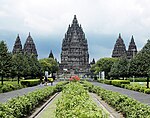
پرامبانان Symmetrically arranged stone bulidings. The steep roofs are decorated with a large number of small stupas. جاوه مرکزی  اندونزی
۷°۴۵′۸″ جنوبی ۱۱۰°۲۹′۳۰″ شرقی / ۷٫۷۵۲۲۲°جنوبی ۱۱۰٫۴۹۱۶۷°شرقی / -7.75222; 110.49167 (Prambanan Temple Compounds)
فرهنگی:
(i), (iv)
۱۹۹۱ [۲۸]
پارک ملی پورتوپرنسس A river flowing into a cave. پالاوان،  فیلیپین
۱۰°۱۰′۰″ شمالی ۱۱۸°۵۵′۰″ شرقی / ۱۰٫۱۶۶۶۷°شمالی ۱۱۸٫۹۱۶۶۷°شرقی / 10.16667; 118.91667 (Puerto-Princesa Subterranean River National Park)
طبیعی:
(vii), (x)
۵٬۷۵۳ (۱۴٬۲۲۰) ۱۹۹۹ [۲۹]
Rice Terraces of the Philippine Cordilleras Small village among rice terraces. ایفوگائو، Cordillera Region, لوزون[نیازمند ابهام‌زدایی],  فیلیپین
۱۶°۵۶′۲″ شمالی ۱۲۱°۸′۱۲″ شرقی / ۱۶٫۹۳۳۸۹°شمالی ۱۲۱٫۱۳۶۶۷°شرقی / 16.93389; 121.13667 (Rice Terraces of the Philippine Cordilleras)
فرهنگی:
(iii), (iv), (v)
۱۹۹۵ The site has been listed as فهرست میراث جهانی در معرض خطر since 2001 due to the absence of a systematic monitoring programme or of a comprehensive management plan. [۳۰][۳۱]
Sangiran Early Man Site Upper part of a petrified skull including some teeth. جاوه مرکزی  اندونزی
۷°۲۴′۰″ جنوبی ۱۱۰°۴۹′۰″ شرقی / ۷٫۴۰۰۰۰°جنوبی ۱۱۰٫۸۱۶۶۷°شرقی / -7.40000; 110.81667 (Sangiran Early Man Site)
فرهنگی:
(iii), (vi)
۵٬۶۰۰ (۱۴٬۰۰۰) ۱۹۹۶ [۳۲]
نیایشگاه پرهه ویهر Ruins of a stone building erected on a stone platform. The roof above the main entrance is decorated. Preah Vihear Province,  کامبوج
۱۴°۲۳′۱۸″ شمالی ۱۰۴°۴۱′۲″ شرقی / ۱۴٫۳۸۸۳۳°شمالی ۱۰۴٫۶۸۳۸۹°شرقی / 14.38833; 104.68389 (Temple of Preah Vihear)
فرهنگی:
(i)
۱۵۵ (۳۸۰); buffer zone ۲٬۶۴۳ (۶٬۵۳۰) ۲۰۰۸ [۳۳]
پناهگاه حیات وحش سونگایایی-Huai Kha Khaeng Wildlife Sanctuaries
A river flowing through a forested mountain landscape.
کانتچانابوری، استان تاک and یوتای تانیs  تایلند
۱۵°۲۰′ شمالی ۹۸°۵۵′ شرقی / ۱۵٫۳۳۳°شمالی ۹۸٫۹۱۷°شرقی / 15.333; 98.917 (Thungyai-Huai Kha Khaeng Wildlife Sanctuaries)
طبیعی:
(vii), (ix), (x)
۶۲۲٬۲۰۰ (۱٬۵۳۷٬۰۰۰) ۱۹۹۱ [۳۴]
لوآنگ پرابانگ Stone building with golden decorated entrance, stacked and very steep roofs. استان لوآنگ پرابانگ،  لائوس
۱۹°۵۳′۲۰″ شمالی ۱۰۲°۸′۰″ شرقی / ۱۹٫۸۸۸۸۹°شمالی ۱۰۲٫۱۳۳۳۳°شرقی / 19.88889; 102.13333 (Town of Luang Prabang)
فرهنگی:
(ii), (iv), (v)
۱۹۹۵ [۳۵]
Tropical Rainforest Heritage of Sumatra سوماترا،  اندونزی
۲°۳۰′ جنوبی ۱۰۱°۳۰′ شرقی / ۲٫۵۰۰°جنوبی ۱۰۱٫۵۰۰°شرقی / -2.500; 101.500 (Tropical Rainforest Heritage of Sumatra)
Natural:
(vii), (ix), (x)
۲٬۵۹۵٬۱۲۴ (۶٬۴۱۲٬۶۹۰) ۲۰۰۴ The site has been listed as فهرست میراث جهانی در معرض خطر since 2011 due to poaching, illegal logging, agricultural encroachment, and plans to build roads. [۳۶][۳۷]
آب‌سنگ مرجانی توباتا Shark and corrals. Cagayancillo, پالاوان،  فیلیپین
۸°۵۷′۱۲″ شمالی ۱۱۹°۵۲′۳″ شرقی / ۸٫۹۵۳۳۳°شمالی ۱۱۹٫۸۶۷۵۰°شرقی / 8.95333; 119.86750 (Tubbataha Reefs Natural Park)
طبیعی:
(vii), (ix), (x)
۱۳۰٬۰۲۸ (۳۲۱٬۳۱۰) ۱۹۹۳[nb ۳] [۳۸][۳۹]
Ujung Kulon National Park Rocky ground within a tropical forest. بانتن and لامپونگ،  اندونزی
۶°۴۵′ جنوبی ۱۰۵°۲۰′ شرقی / ۶٫۷۵۰°جنوبی ۱۰۵٫۳۳۳°شرقی / -6.750; 105.333 (Ujung Kulon National Park)
طبیعی:
(vii), (x)
۷۸٬۵۲۵ (۱۹۴٬۰۴۰) ۱۹۹۱ [۴۰]
Vat Phou and Associated Ancient Settlements within the Champasak Cultural Landscape Ruins of stone buildings in a very green lush mountain landscape. استان چامپاساک،  لائوس
۱۴°۵۰′۵۴″ شمالی ۱۰۵°۴۹′۲۰″ شرقی / ۱۴٫۸۴۸۳۳°شمالی ۱۰۵٫۸۲۲۲۲°شرقی / 14.84833; 105.82222 (Vat Phou and Associated Ancient Settlements within the Champasak Cultural Landscape)
فرهنگی:
(iii), (iv), (vi)
۳۹٬۰۰۰ (۹۶٬۰۰۰) ۲۰۰۱ [۴۱]

یادداشت‌ها

[ویرایش]
  1. The Jerusalem site is not associated with a state by UNESCO and sorts as "Jerusalem".
  2. Extended inscription in 2000 to include natural criterion (i) (in present nomenclature criterion (vii)).
  3. Extended in 2009 and name change from Tubbataha Reef Marine Park to the present name.

منابع

[ویرایش]
عمومی
  • «World Heritage Committee: Sixteenth session» (PDF). UNESCO. دریافت‌شده در ۲۸ مه ۲۰۱۰.
  • «World Heritage Committee: Twenty-eighth session» (PDF). UNESCO. دریافت‌شده در ۲۶ ژوئن ۲۰۱۱.
یادداشت
  1. "Number of World Heritage Properties by region". یونسکو. Retrieved 10 September 2011.
  2. "Composition of macro geographical (continental) regions, geographical sub-regions, and selected economic and other groupings". Geographical region and composition of each region. United Nations Statistics Division. 2010. Retrieved 20 October 2011.
  3. ۳٫۰ ۳٫۱ "World Heritage List". UNESCO. Retrieved 28 May 2010. خطای یادکرد: برچسب <ref> نامعتبر؛ نام «list» چندین بار با محتوای متفاوت تعریف شده است. (صفحهٔ راهنما را مطالعه کنید.).
  4. "Number of World Heritage properties inscribed each Year". UNESCO. Retrieved 8 September 2011.
  5. "List of World Heritage in Danger". UNESCO. Retrieved 10 December 2010.
  6. «Angkor». یونسکو. دریافت‌شده در ۲۸ مه ۲۰۱۰.
  7. (16th session ۱۹۹۲، صص. 37–38, annex VI)
  8. (28th session ۲۰۰۴، صص. ۶۶–۶۷)
  9. «Ban Chiang Archaeological Site». UNESCO. دریافت‌شده در ۲۸ مه ۲۰۱۰.
  10. «Baroque Churches of the Philippines». UNESCO. دریافت‌شده در ۲۸ مه ۲۰۱۰.
  11. «Borobudur Temple Compounds». UNESCO. دریافت‌شده در ۲۸ مه ۲۰۱۰.
  12. «Central Sector of the Imperial Citadel of Thang Long - Hanoi». UNESCO. دریافت‌شده در ۲۸ مه ۲۰۱۰.
  13. «Citadel of the Ho Dynasty». UNESCO. دریافت‌شده در ۲۸ مه ۲۰۱۰.
  14. «Complex of Hué Monuments». UNESCO. دریافت‌شده در ۲۸ مه ۲۰۱۰.
  15. «Dong Phayayen-Khao Yai Forest Complex». UNESCO. دریافت‌شده در ۲۸ مه ۲۰۱۰.
  16. «Gunung Mulu National Park». UNESCO. دریافت‌شده در ۲۸ مه ۲۰۱۰.
  17. «Ha Long Bay». UNESCO. دریافت‌شده در ۲۸ مه ۲۰۱۰.
  18. «Historic City of Ayutthaya». UNESCO. دریافت‌شده در ۲۸ مه ۲۰۱۰.
  19. «Historic Town of Sukhothai and Associated Historic Towns». UNESCO. دریافت‌شده در ۲۸ مه ۲۰۱۰.
  20. «Historic Town of Vigan». UNESCO. دریافت‌شده در ۲۸ مه ۲۰۱۰.
  21. «Hoi An Ancient Town». UNESCO. دریافت‌شده در ۲۸ مه ۲۰۱۰.
  22. «Kinabalu Park». UNESCO. دریافت‌شده در ۲۸ مه ۲۰۱۰.
  23. «Komodo National Park». UNESCO. دریافت‌شده در ۲۸ مه ۲۰۱۰.
  24. «Lorentz National Park». UNESCO. دریافت‌شده در ۲۸ مه ۲۰۱۰.
  25. «Melaka and George Town, Historic Cities of the Straits of Malacca». UNESCO. دریافت‌شده در ۲۸ مه ۲۰۱۰.
  26. «My Son Sanctuary». UNESCO. دریافت‌شده در ۲۸ مه ۲۰۱۰.
  27. «Phong Nha-Ke Bang National Park». UNESCO. دریافت‌شده در ۲۸ مه ۲۰۱۰.
  28. «Prambanan Temple Compounds». UNESCO. دریافت‌شده در ۲۸ مه ۲۰۱۰.
  29. «Puerto-Princesa Subterranean River National Park». UNESCO. دریافت‌شده در ۲۸ مه ۲۰۱۰.
  30. «Rice Terraces of the Philippine Cordilleras». یونسکو. دریافت‌شده در ۲۸ مه ۲۰۱۰.
  31. (15th session ۲۰۰۱، صص. ۱۳۹–۱۴۱)
  32. «Sangiran Early Man Site». UNESCO. دریافت‌شده در ۲۸ مه ۲۰۱۰.
  33. «Temple of Preah Vihear». UNESCO. دریافت‌شده در ۲۸ مه ۲۰۱۰.
  34. «Thungyai-Huai Kha Khaeng Wildlife Sanctuaries». UNESCO. دریافت‌شده در ۲۸ مه ۲۰۱۰.
  35. «Town of Luang Prabang». UNESCO. دریافت‌شده در ۲۸ مه ۲۰۱۰.
  36. «Tropical Rainforest Heritage of Sumatra». UNESCO. دریافت‌شده در ۲۵ ژوئن ۲۰۱۱.
  37. «Danger listing for Indonesia's Tropical Rainforest Heritage of Sumatra». UNESCO. دریافت‌شده در ۲۶ ژوئیه ۲۰۱۱.
  38. «Tubbataha Reefs Natural Park». UNESCO. دریافت‌شده در ۲۸ مه ۲۰۱۰.
  39. «Decision - 33COM 8B.3 - Natural properties - Extension of properties already inscribed on the World Heritage List - Tubbataha Reef Marine Park (Philippines)». UNESCO. دریافت‌شده در ۲۸ مه ۲۰۱۰.
  40. «Ujung Kulon National Park». UNESCO. دریافت‌شده در ۲۸ مه ۲۰۱۰.
  41. «Vat Phou and Associated Ancient Settlements within the Champasak Cultural Landscape». UNESCO. دریافت‌شده در ۲۸ مه ۲۰۱۰.