پرش به محتوا

فهرست میراث جهانی در جنوب آسیا

از ویکی‌پدیا، دانشنامهٔ آزاد

فهرست میراث جهانی در جنوب آسیا شامل ۵۱ میراث جهانی در ۶ کشورافغانستان، پاکستان، هند، نپال، سری‌لانکا و بنگلادش می‌شود و پادشاهی بوتان نیز در این منطقه قرار دارد که بدون هیچ میراث می‌باشد.[۱][۲] در این منطقه از آسیا هند با ۲۸ میراث ثبت شده در یونسکو بیشترین میراث جهانی را دارد.[۳] پارک ملی ساگارماتا و دره کاتماندو در نپال نخستین مکان‌هایی بودند که در ۱۹۷۹ در این منطقه در فهرست میراث جهانی ثبت شدند.[۴] از ۵۱ میراث ثبت شده از ۷۱ میراث ثبت شده ۴۱ میراث فرهنگی، ۱۰ میراث طبیعی است.[۳] تندیس‌های بودا در بامیان ، منار جام در افغانستان از جمله سه میراث در خطر این منطقه از آسیا هستند.[۵]

شرح

[ویرایش]
نمایش مختصات در نقشهٔ: اوپن‌استریت‌مپ 
بارگیری مختصات: KML
نام; توسط کمیته میراث جهانی فهرست شده اند[۶]
مکان; شهر ٬استان یا نام کشور، با مختصات [nb ۱]
معیارها; ذکر شده برای میراث
مساحت; برپایه هکتار
سال; سالی که در فهرست میراث جهانی ثبت شده‌است.
خطر; سال قرار گرفتن فهرست میراث جهانی در معرض خطر
دلیل;تهدید مورد نظر

فهرست میراث

[ویرایش]
  † در خطر
منطقه تصویر موقعیت میراث جهانی یونسکو مساحت
هکتار(جریب)
سال توضیحات منابع
قلعه آگره
Decorated gate to a fortress of red stone.
آگره, اوتار پرادش,  هند
۲۷°۱۱′۰″ شمالی ۷۸°۲′۰″ شرقی / ۲۷٫۱۸۳۳۳°شمالی ۷۸٫۰۳۳۳۳°شرقی / 27.18333; 78.03333 (Agra Fort)
فرهنگی:
(iii)
۱۹۸۳ [۷]
غارهای آجانتا A line of caves, some with columns on the outside, along a rock face. Aurangabad District, مهاراشترا,  هند
۲۰°۳۳′۱۲″ شمالی ۷۵°۴۲′۰″ شرقی / ۲۰٫۵۵۳۳۳°شمالی ۷۵٫۷۰۰۰۰°شرقی / 20.55333; 75.70000 (Ajanta Caves)
فرهنگی:
(i), (ii), (iii), (vi)
۱۹۸۳ [۸]
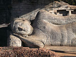
پولونارووا Upper part of a reclining Buddha. ناحیه پولونارووا, North Central Province,  سری‌لانکا
۷°۵۴′۵۷″ شمالی ۸۱°۰′۲″ شرقی / ۷٫۹۱۵۸۳°شمالی ۸۱٫۰۰۰۵۶°شرقی / 7.91583; 81.00056 (Ancient City of Polonnaruwa)
فرهنگی:
(ii), (iii), (vi)
۱۹۸۲ [۹]
سیگیرییا Foundations of buildings and in the distance a large rock several hundred metres high. ناحیه متاله, Central Province,  سری‌لانکا
۷°۵۷′۰″ شمالی ۸۰°۴۵′۰″ شرقی / ۷٫۹۵۰۰۰°شمالی ۸۰٫۷۵۰۰۰°شرقی / 7.95000; 80.75000 (Ancient City of Sigiriya)
فرهنگی:
(ii), (iii), (iv)
۱۹۸۲ [۱۰]
موهن‌جو دارو استان سند,  پاکستان
۲۷°۱۹′۴۵″ شمالی ۶۸°۸′۲۰″ شرقی / ۲۷٫۳۲۹۱۷°شمالی ۶۸٫۱۳۸۸۹°شرقی / 27.32917; 68.13889 (Archaeological Ruins at Moenjodaro)
فرهنگی:
(ii), (iii)
۲۴۰ (۵۹۰) ۱۹۸۰ [۱۱]
سانچی A heavily decorated gate in front of a stupa. Raisen District, مادایا پرادش,  هند
۲۳°۲۸′۴۶″ شمالی ۷۷°۴۴′۲۳″ شرقی / ۲۳٫۴۷۹۴۴°شمالی ۷۷٫۷۳۹۷۲°شرقی / 23.47944; 77.73972 (Buddhist Monuments at Sanchi)
فرهنگی:
(i), (ii), (iii), (iv), (vi)
۱۹۸۹ [۱۲]
Buddhist Ruins of Takht-i-Bahi and Neighbouring City Remains at Sahr-i-Bahlol خیبر پختونخوا,  پاکستان
۳۴°۱۹′۱۵″ شمالی ۷۱°۵۶′۴۵″ شرقی / ۳۴٫۳۲۰۸۳°شمالی ۷۱٫۹۴۵۸۳°شرقی / 34.32083; 71.94583 (Buddhist Ruins of Takht-i-Bahi and Neighbouring City Remains at Sahr-i-Bahlol)
فرهنگی:
(iv)
۱۹۸۰ [۱۳]
Central Highlands of Sri Lanka Forested mountains, a settlement, a lake and a characteristic peak in the distance.  سری‌لانکا
۷°۲۷′۹″ شمالی ۸۰°۴۸′۸″ شرقی / ۷٫۴۵۲۵۰°شمالی ۸۰٫۸۰۲۲۲°شرقی / 7.45250; 80.80222 (Central Highlands of Sri Lanka)
طبیعی:
(ix), (x)
۵۶٬۸۴۴ (۱۴۰٬۴۶۰); buffer zone ۷۲٬۶۴۵ (۱۷۹٬۵۱۰) ۲۰۱۰ [۱۴]
پارک باستان‌شناسی چامپانر-پاواگاه Pavagadh Hill Panchmahal district, گجرات,  هند
۲۲°۲۹′۰″ شمالی ۷۳°۳۲′۰″ شرقی / ۲۲٫۴۸۳۳۳°شمالی ۷۳٫۵۳۳۳۳°شرقی / 22.48333; 73.53333 (Champaner-Pavagadh Archaeological Park)
فرهنگی:
(iii), (iv), (v), (vi)
۱٬۳۲۹ (۳٬۲۸۰); buffer zone ۲٬۹۱۲ (۷٬۲۰۰) ۲۰۰۴ [۱۵]
پایانه چاتراپاتی شیواجی Large building of reddish stone with columns, cupolas and turrets. The main cupola is topped by a human sculpture. بمبئی, مهاراشترا,  هند
۱۸°۵۶′۲۴″ شمالی ۷۲°۵۰′۱۰″ شرقی / ۱۸٫۹۴۰۰۰°شمالی ۷۲٫۸۳۶۱۱°شرقی / 18.94000; 72.83611 (Chhatrapati Shivaji Terminus (formerly Victoria Terminus))
فرهنگی:
(ii), (iv)
۲٫۸۵ (۷٫۰) ۲۰۰۴ [۱۶]
Chitwan National Park A lake with tree trunks in the water. Chitwan District, Narayani Zone,    نپال
۲۷°۳۰′۰″ شمالی ۸۴°۲۰′۰″ شرقی / ۲۷٫۵۰۰۰۰°شمالی ۸۴٫۳۳۳۳۳°شرقی / 27.50000; 84.33333 (Chitwan National Park)
طبیعی:
(vii), (ix), (x)
۹۳٬۲۰۰ (۲۳۰٬۰۰۰) ۱۹۸۴ [۱۷]
شهر قدیم گوا
A stone church.
گوا,  هند
۱۵°۳۰′۸″ شمالی ۷۳°۵۴′۴۲″ شرقی / ۱۵٫۵۰۲۲۲°شمالی ۷۳٫۹۱۱۶۷°شرقی / 15.50222; 73.91167 (Churches and Convents of Goa)
فرهنگی:
(ii), (iv), (vi)
۱۹۸۶ [۱۸]
تندیس‌های بودا در بامیان
A large niche in a rock with the outline of a human figure.
ولایت بامیان,  افغانستان
۳۴°۴۹′۵۵″ شمالی ۶۷°۴۹′۳۶″ شرقی / ۳۴٫۸۳۱۹۴°شمالی ۶۷٫۸۲۶۶۷°شرقی / 34.83194; 67.82667 (Cultural Landscape and Archaeological Remains of the Bamiyan Valley)
فرهنگی:
(i), (ii), (iii), (iv), (vi)
۱۵۹ (۳۹۰) ۲۰۰۳ The site has been listed as فهرست میراث جهانی در معرض خطر since its inscription due to fragile conservation state following abandonment, military action and dynamite explosions; causing dangers such as risk of collapse of Buddha niches, further deterioration of cave murals, looting and illicit excavations. [۱۹][۲۰]
غارهای الفنتا
Sculpture of a three-headed figure.
Elephanta Island, Kolaba district, مهاراشترا,  هند
۱۸°۵۸′۰″ شمالی ۷۲°۵۶′۹″ شرقی / ۱۸٫۹۶۶۶۷°شمالی ۷۲٫۹۳۵۸۳°شرقی / 18.96667; 72.93583 (Elephanta Caves)
فرهنگی:
(i), (iii)
۱۹۸۷ [۲۱]
غارهای الورا Heavily decorated religious structure cut from dark rock. Verul , Aurangabad District, مهاراشترا,  هند
۲۰°۱′۳۵″ شمالی ۷۵°۱۰′۴۵″ شرقی / ۲۰٫۰۲۶۳۹°شمالی ۷۵٫۱۷۹۱۷°شرقی / 20.02639; 75.17917 (Ellora Caves)
فرهنگی:
(i), (iii), (vi)
۱۹۸۳ [۲۲]
فاتح پور سیکری آگره, اوتار پرادش,  هند
۲۷°۵′۴۰″ شمالی ۷۷°۳۹′۵۱″ شرقی / ۲۷٫۰۹۴۴۴°شمالی ۷۷٫۶۶۴۱۷°شرقی / 27.09444; 77.66417 (Fatehpur Sikri)
فرهنگی:
(ii), (iii), (iv)
۱۹۸۶ [۲۳]
قلعه لاهور و باغ شالیمار Entrance gate to a fort flanked by two large towers. پنجاب (پاکستان),  پاکستان
۳۱°۳۵′۲۵″ شمالی ۷۴°۱۸′۳۵″ شرقی / ۳۱٫۵۹۰۲۸°شمالی ۷۴٫۳۰۹۷۲°شرقی / 31.59028; 74.30972 (Fort and Shalamar Gardens in Lahore)
فرهنگی:
(i), (ii), (iii)
۱۹۸۱ The site has been listed as فهرست میراث جهانی در معرض خطر since 2000 because of the destruction of historic water tanks in 1999 to widen a road and deteriorating perimeter walls of the Garden, listed on request of the Pakistan government [۲۴][۲۵]
Golden Temple of Dambulla Stupa and statues of bodhisattvas inside a cave. ناحیه متاله, Central Province,  سری‌لانکا
۷°۵۱′۲۴″ شمالی ۸۰°۳۸′۵۷″ شرقی / ۷٫۸۵۶۶۷°شمالی ۸۰٫۶۴۹۱۷°شرقی / 7.85667; 80.64917 (Golden Temple of Dambulla)
فرهنگی:
(i), (vi)
۱۹۹۱ [۲۶]
معابد بزرگ لیوینگ چولا
A sculpture of a human shaped figure in a niche.
 هند
۱۰°۴۶′۵۹″ شمالی ۷۹°۷′۵۷″ شرقی / ۱۰٫۷۸۳۰۶°شمالی ۷۹٫۱۳۲۵۰°شرقی / 10.78306; 79.13250 (Great Living Chola Temples)
فرهنگی:
(ii), (iii)
۲۲ (۵۴); buffer zone ۱۷ (۴۲) ۱۹۸۷[nb ۲] [۲۷]
هامپی
Ruins of a large decorated building.
Bellary district, کارناتاکا,  هند
۱۵°۱۸′۵۲″ شمالی ۷۶°۲۸′۱۸″ شرقی / ۱۵٫۳۱۴۴۴°شمالی ۷۶٫۴۷۱۶۷°شرقی / 15.31444; 76.47167 (Group of Monuments at Hampi)
فرهنگی:
(i), (iii), (iv)
۱۹۸۶ [۲۸]
مجموعه تاریخی ماهابالی پورام
Ruins of a sandstone building with columns.
Chingleput district, تامیل نادو,  هند
۱۲°۳۷′۰″ شمالی ۸۰°۱۱′۳۰″ شرقی / ۱۲٫۶۱۶۶۷°شمالی ۸۰٫۱۹۱۶۷°شرقی / 12.61667; 80.19167 (Group of Monuments at Mahabalipuram)
فرهنگی:
(i), (ii), (iii), (vi)
۱۹۸۴ [۲۹]
پاتاداکال Stone structure decorated with columns, reliefs and sculptures and a high roof about the central part. Badami, Bijapur district, کارناتاکا,  هند
۱۵°۵۶′۵۴″ شمالی ۷۵°۴۹′۰″ شرقی / ۱۵٫۹۴۸۳۳°شمالی ۷۵٫۸۱۶۶۷°شرقی / 15.94833; 75.81667 (Group of Monuments at Pattadakal)
فرهنگی:
(iii), (iv)
۵٫۵۶ (۱۳٫۷); buffer zone ۱۱۳ (۲۸۰) ۱۹۸۷ [۳۰]
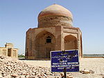
Historical Monuments at Makli, Thatta Ruins of an octagonal building crowned by a cupola. استان سند,  پاکستان
۲۴°۴۶′۰″ شمالی ۶۷°۵۴′۰″ شرقی / ۲۴٫۷۶۶۶۷°شمالی ۶۷٫۹۰۰۰۰°شرقی / 24.76667; 67.90000 (Historical Monuments at Makli, Thatta)
فرهنگی:
(iii)
۱۹۸۱ [۳۱]
Historic Mosque City of Bagerhat
Building of red bricks with a roof consisting of many white domes. There are small round towers on the corners of the building each crowned by a white cupola.
ناحیه باگرهات, استان کولنا,  بنگلادش
۲۲°۴۰′۰″ شمالی ۸۹°۴۸′۰″ شرقی / ۲۲٫۶۶۶۶۷°شمالی ۸۹٫۸۰۰۰۰°شرقی / 22.66667; 89.80000 (Historic Mosque City of Bagerhat)
فرهنگی:
(iv)
۱۹۸۵ [۳۲]
آرامگاه همایون Red and white stone building topped by a large white cupola and many small turrets. دهلی,  هند
۲۸°۳۵′۳۶″ شمالی ۷۷°۱۵′۲″ شرقی / ۲۸٫۵۹۳۳۳°شمالی ۷۷٫۲۵۰۵۶°شرقی / 28.59333; 77.25056 (Humayun's Tomb, Delhi)
فرهنگی:
(ii), (iv)
۱۹۹۳ [۳۳]
Kathmandu Valley Streetscene with various characteristically shaped temple buildings. Kathmandu Valley,    نپال
۲۷°۴۲′۱۴″ شمالی ۸۵°۱۸′۳۱″ شرقی / ۲۷٫۷۰۳۸۹°شمالی ۸۵٫۳۰۸۶۱°شرقی / 27.70389; 85.30861 (Kathmandu Valley)
فرهنگی:
(iii), (iv), (vi)
۱۶۷ (۴۱۰); buffer zone ۷۰ (۱۷۰) ۱۹۷۹[nb ۳] The site has been listed as فهرست میراث جهانی در معرض خطر 2003–2007 due to the partial or substantial loss of the traditional elements of six out of seven monument zones and resulting general loss of authenticity and integrity of the whole property. [۳۴]
پارک ملی کازیرانگا Grassland with a rhinoceros. آسام,  هند
۲۶°۴۰′ شمالی ۹۳°۲۵′ شرقی / ۲۶٫۶۶۷°شمالی ۹۳٫۴۱۷°شرقی / 26.667; 93.417 (Kaziranga National Park)
طبیعی:
(ix), (x)
۴۲٬۹۹۶ (۱۰۶٬۲۵۰) ۱۹۸۵ [۳۵]
پارک ملی کلادو Grassland under water with deer and a flying heron. راجستان,  هند
۲۷°۹′۳۲″ شمالی ۷۷°۳۰′۳۱″ شرقی / ۲۷٫۱۵۸۸۹°شمالی ۷۷٫۵۰۸۶۱°شرقی / 27.15889; 77.50861 (Keoladeo National Park)
طبیعی:
(x)
۲٬۸۷۳ (۷٬۱۰۰) ۱۹۸۵ [۳۶]
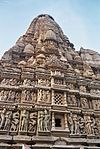
خاجوراهو
Very tall stone structure decorated all over with sculptures.
مادایا پرادش,  هند
۲۴°۵۱′۸″ شمالی ۷۹°۵۵′۲۰″ شرقی / ۲۴٫۸۵۲۲۲°شمالی ۷۹٫۹۲۲۲۲°شرقی / 24.85222; 79.92222 (Khajuraho Group of Monuments)
فرهنگی:
(i), (iii)
۱۹۸۶ [۳۷]
لومبینی A large tree next to a water filled pool. Rupandehi District, Lumbini Zone,    نپال
۲۷°۲۸′۸″ شمالی ۸۳°۱۶′۳۴″ شرقی / ۲۷٫۴۶۸۸۹°شمالی ۸۳٫۲۷۶۱۱°شرقی / 27.46889; 83.27611 (Lumbini, the Birthplace of the Lord Buddha)
فرهنگی:
(iii), (vi)
۱٫۹۵ (۴٫۸); buffer zone ۲۳ (۵۷) ۱۹۹۷ [۳۸]
پرستشگاه ماهابودی
Very tall steep pyramid shaped stone building with reliefs all over the surfaces.
بیهار,  هند
۲۴°۴۱′۴۳″ شمالی ۸۴°۵۹′۳۸″ شرقی / ۲۴٫۶۹۵۲۸°شمالی ۸۴٫۹۹۳۸۹°شرقی / 24.69528; 84.99389 (Mahabodhi Temple Complex at Bodh Gaya)
فرهنگی:
(i), (ii), (iii), (iv), (vi)
۴٫۸۶ (۱۲٫۰) ۲۰۰۲ [۳۹]
پارک ملی مناس
Suspension bridge across a river in a forested mountain landscape.
آسام,  هند
۲۶°۴۳′۳۰″ شمالی ۹۱°۱′۵۰″ شرقی / ۲۶٫۷۲۵۰۰°شمالی ۹۱٫۰۳۰۵۶°شرقی / 26.72500; 91.03056 (Manas National Park)
طبیعی:
(vii), (ix), (x)
۳۹٬۱۰۰ (۹۷٬۰۰۰) ۱۹۸۵ [۴۰]
منار جام A tall minaret in a river valley. At the top of the nearby mountains there are other, smaller structures. ولایت غور,  افغانستان
۳۴°۲۳′۴۸″ شمالی ۶۴°۳۰′۵۸″ شرقی / ۳۴٫۳۹۶۶۷°شمالی ۶۴٫۵۱۶۱۱°شرقی / 34.39667; 64.51611 (Minaret and Archaeological Remains of Jam)
فرهنگی:
(ii), (iii), (iv)
۷۰ (۱۷۰) ۲۰۰۲ The site has been listed as فهرست میراث جهانی در معرض خطر since its inscription due to lack of legal protection, lack of protection measure or management plan and the generally poor condition of the site. [۴۱][۴۲]
ریل‌های کوهستانی هندوستان
A small steam locomotive with three blue carriages.
 هند
۱۱°۳۰′۳۷″ شمالی ۷۶°۵۶′۹″ شرقی / ۱۱٫۵۱۰۲۸°شمالی ۷۶٫۹۳۵۸۳°شرقی / 11.51028; 76.93583 (Mountain Railways of India)
فرهنگی:
(ii), (iv)
۸۹ (۲۲۰); buffer zone ۶۴۵ (۱٬۵۹۰) ۱۹۹۹[nb ۴] [۴۳][۴۴][۴۵]
پارک ملی ناندا دوی و پارک ملی دره گلها
Mountain valley full of pink flowers.
اوتاراکند,  هند
۳۰°۴۳′ شمالی ۷۹°۴۰′ شرقی / ۳۰٫۷۱۷°شمالی ۷۹٫۶۶۷°شرقی / 30.717; 79.667 (Nanda Devi and Valley of Flowers National Parks)
طبیعی:
(vii), (x)
۷۱٬۷۸۳ (۱۷۷٬۳۸۰); buffer zone ۵۱۴٬۲۸۶ (۱٬۲۷۰٬۸۳۰) ۱۹۸۸[nb ۵] [۴۶]
گالی A white church and white lighthouse near the sea. Galle, Southern Province,  سری‌لانکا
۶°۱′۱۷″ شمالی ۸۰°۱۳′۷″ شرقی / ۶٫۰۲۱۳۹°شمالی ۸۰٫۲۱۸۶۱°شرقی / 6.02139; 80.21861 (Old Town of Galle and its Fortifications)
فرهنگی:
(iv)
۱۹۸۸ [۴۷]
قطب منار
Red and white building with a white dome and a tall tower or minaret with varying cross sections depending on height.
دهلی,  هند
۲۸°۳۱′۳۳″ شمالی ۷۷°۱۱′۷″ شرقی / ۲۸٫۵۲۵۸۳°شمالی ۷۷٫۱۸۵۲۸°شرقی / 28.52583; 77.18528 (Qutb Minar and its Monuments, Delhi)
فرهنگی:
(iv)
۱۹۹۳ [۴۸]
قلعه سرخ (دهلی) Gate in a red wall crowned by various small cupolas and turrets. دهلی,  هند
۲۸°۳۹′۲۰″ شمالی ۷۷°۱۴′۲۷″ شرقی / ۲۸٫۶۵۵۵۶°شمالی ۷۷٫۲۴۰۸۳°شرقی / 28.65556; 77.24083 (Red Fort Complex)
فرهنگی:
(ii), (iii), (vi)
۴۹ (۱۲۰); buffer zone ۴۳ (۱۱۰) ۲۰۰۷ [۴۹]
پناهگاه‌های صخره‌ای بهیمبتکا Red rock paintings of humans and humans on horses. مادایا پرادش,  هند
۲۲°۵۵′۴۰″ شمالی ۷۷°۳۵′۰″ شرقی / ۲۲٫۹۲۷۷۸°شمالی ۷۷٫۵۸۳۳۳°شرقی / 22.92778; 77.58333 (Rock Shelters of Bhimbetka)
فرهنگی:
(iii), (v)
۱٬۸۹۳ (۴٬۶۸۰); buffer zone ۱۰٬۲۸۰ (۲۵٬۴۰۰) ۲۰۰۳ [۵۰]
Rohtas Fort Ruins of the gate to a fortress. جهلم (شهر), پنجاب (پاکستان),  پاکستان
۳۲°۵۷′۴۵″ شمالی ۷۳°۳۵′۲۰″ شرقی / ۳۲٫۹۶۲۵۰°شمالی ۷۳٫۵۸۸۸۹°شرقی / 32.96250; 73.58889 (Rohtas Fort)
فرهنگی:
(ii), (iv)
۱۹۹۷ [۵۱]
Ruins of the Buddhist Vihara at Paharpur
Ruins of a structure of red stone now resembling a small hill or mound.
ناحیه نوگان, استان راج‌شاهی,  بنگلادش
۲۵°۲′۰″ شمالی ۸۸°۵۹′۰″ شرقی / ۲۵٫۰۳۳۳۳°شمالی ۸۸٫۹۸۳۳۳°شرقی / 25.03333; 88.98333 (Ruins of the Buddhist Vihara at Paharpur)
فرهنگی:
(i), (ii), (vi)
۱۹۸۵ [۵۲]
انورادهاپورا A large white stupa with an orange border near the bottom. ناحیه انورادهاپورا, North Central Province,  سری‌لانکا
۸°۲۰′۰″ شمالی ۸۰°۲۳′۰″ شرقی / ۸٫۳۳۳۳۳°شمالی ۸۰٫۳۸۳۳۳°شرقی / 8.33333; 80.38333 (Sacred City of Anuradhapura)
فرهنگی:
(ii), (iii), (vi)
۱۹۸۲ [۵۳]
کندی (سری‌لانکا) Administrative or religious building. Central Province,  سری‌لانکا
۷°۱۷′۳۷″ شمالی ۸۰°۳۸′۲۵″ شرقی / ۷٫۲۹۳۶۱°شمالی ۸۰٫۶۴۰۲۸°شرقی / 7.29361; 80.64028 (Sacred City of Kandy)
فرهنگی:
(iv), (vi)
۱۹۸۸ [۵۴]
Sagarmatha National Park A village in a large mountain valley. In the distance very high snow-covered mountains are visible. Solukhumbu District, Sagarmatha Zone,    نپال
۲۷°۵۷′۵۵″ شمالی ۸۶°۵۴′۴۷″ شرقی / ۲۷٫۹۶۵۲۸°شمالی ۸۶٫۹۱۳۰۶°شرقی / 27.96528; 86.91306 (Sagarmatha National Park)
طبیعی:
(vii)
۱۲۴٬۴۰۰ (۳۰۷٬۰۰۰) ۱۹۷۹ [۵۵]
Sinharaja Forest Reserve Forested hilly landscape. استان ساباراگامووا and Southern Province,  سری‌لانکا
۶°۲۵′ شمالی ۸۰°۳۰′ شرقی / ۶٫۴۱۷°شمالی ۸۰٫۵۰۰°شرقی / 6.417; 80.500 (Sinharaja Forest Reserve)
طبیعی:
(ix), (x)
۸٬۸۶۴ (۲۱٬۹۰۰) ۱۹۸۸ [۵۶]
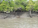
پارک ملی سانداربنس Mangroves on a riverbank. بنگال غربی,  هند
۲۱°۵۶′۴۲″ شمالی ۸۸°۵۳′۴۵″ شرقی / ۲۱٫۹۴۵۰۰°شمالی ۸۸٫۸۹۵۸۳°شرقی / 21.94500; 88.89583 (Sundarbans National Park)
طبیعی:
(ix), (x)
۱۳۳٬۰۱۰ (۳۲۸٬۷۰۰) ۱۹۸۷ [۵۷]
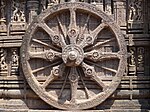
پرستشگاه خورشید کونارک Decorated wheel in stone relief. Puri district, اوریسا,  هند
۱۹°۵۳′۱۵″ شمالی ۸۶°۵′۴۱″ شرقی / ۱۹٫۸۸۷۵۰°شمالی ۸۶٫۰۹۴۷۲°شرقی / 19.88750; 86.09472 (Sun Temple, Konârak)
فرهنگی:
(i), (iii), (vi)
۱۱ (۲۷) ۱۹۸۴ [۵۸]
تاج‌محل A white building with a big and several smaller cupolas framed by four white minarets at each corner. آگره, اوتار پرادش,  هند
۲۷°۱۰′۲۷″ شمالی ۷۸°۲′۳۲″ شرقی / ۲۷٫۱۷۴۱۷°شمالی ۷۸٫۰۴۲۲۲°شرقی / 27.17417; 78.04222 (Taj Mahal)
فرهنگی:
(i)
۱۹۸۳ [۵۹]
تکسیلا Ruins of stone buildings. پنجاب (پاکستان),  پاکستان
۳۳°۴۶′۴۵″ شمالی ۷۲°۵۳′۱۵″ شرقی / ۳۳٫۷۷۹۱۷°شمالی ۷۲٫۸۸۷۵۰°شرقی / 33.77917; 72.88750 (Taxila)
فرهنگی:
(iii), (vi)
۱۹۸۰ [۶۰]
جانتر مانتر A number of stone structures resembling giant sundials and other measurement instruments. جی‌پور, راجستان,  هند
۲۶°۵۵′۲۹″ شمالی ۷۵°۴۹′۳۰″ شرقی / ۲۶٫۹۲۴۷۲°شمالی ۷۵٫۸۲۵۰۰°شرقی / 26.92472; 75.82500 (The Jantar Mantar, Jaipur)
فرهنگی:
(iii), (iv)
۱٫۸۷ (۴٫۶); buffer zone ۱۵ (۳۷) ۲۰۱۰ [۶۱]
سونداربانس
Boat on a river in a densely forested plain.
استان کولنا,  بنگلادش
۲۱°۵۷′۰″ شمالی ۸۹°۱۱′۰″ شرقی / ۲۱٫۹۵۰۰۰°شمالی ۸۹٫۱۸۳۳۳°شرقی / 21.95000; 89.18333 (The Sundarbans)
طبیعی:
(ix), (x)
۱۳۹٬۵۰۰ (۳۴۵٬۰۰۰) ۱۹۹۷ [۶۲]

یادداشت

[ویرایش]
  1. The Jerusalem site is not associated with a state by UNESCO and sorts as "Jerusalem".
  2. Extended in 2004 to include the Brihadisvara Temple Complex in Gangaikondacholapuram and the Airavatesvara Temple Complex in Darasuram and name change from Brihadisvara Temple, Thanjavur to the present name.
  3. Minor modification of boundaries in 2006.
  4. Extended in 2005 to include the Nilgiri Mountain Railway and in 2008 to include the Kalka–Shimla Railway. Name change in 2005 from Darjeeling Himalayan Railway to the present name.
  5. Extended in 2005???

منابع

[ویرایش]
عمومی
  • «World Heritage Committee: Twenty-fourth session» (PDF). UNESCO. دریافت‌شده در ۲۶ ژوئن ۲۰۱۱.
  • «World Heritage Committee: Twenty-seventh session» (PDF). UNESCO. دریافت‌شده در ۲۶ ژوئن ۲۰۱۱.
یادداشت
  1. "Number of World Heritage Properties by region". یونسکو. Retrieved 10 September 2011.
  2. "Composition of macro geographical (continental) regions, geographical sub-regions, and selected economic and other groupings". Geographical region and composition of each region. United Nations Statistics Division. 2010. Retrieved 20 October 2011.
  3. ۳٫۰ ۳٫۱ "World Heritage List". UNESCO. Retrieved 28 May 2010. خطای یادکرد: برچسب <ref> نامعتبر؛ نام «list» چندین بار با محتوای متفاوت تعریف شده است. (صفحهٔ راهنما را مطالعه کنید.).
  4. "Number of World Heritage properties inscribed each Year". UNESCO. Retrieved 8 September 2011.
  5. "World Heritage in Danger". UNESCO. Retrieved 28 May 2010.
  6. "List of World Heritage in Danger". UNESCO. Retrieved 10 December 2010.
  7. «Agra Fort». UNESCO. دریافت‌شده در ۲۸ مه ۲۰۱۰.
  8. «Ajanta Caves». UNESCO. دریافت‌شده در ۲۸ مه ۲۰۱۰.
  9. «Ancient City of Polonnaruwa». UNESCO. دریافت‌شده در ۲۸ مه ۲۰۱۰.
  10. «Ancient City of Sigiriya». UNESCO. دریافت‌شده در ۲۸ مه ۲۰۱۰.
  11. «Archaeological Ruins at Moenjodaro». UNESCO. دریافت‌شده در ۲۸ مه ۲۰۱۰.
  12. «Buddhist Monuments at Sanchi». UNESCO. دریافت‌شده در ۲۸ مه ۲۰۱۱.
  13. «Buddhist Ruins of Takht-i-Bahi and Neighbouring City Remains at Sahr-i-Bahlol». UNESCO. دریافت‌شده در ۲۸ مه ۲۰۱۰.
  14. «Central Highlands of Sri Lanka». UNESCO. دریافت‌شده در ۲۸ مه ۲۰۱۰.
  15. «Champaner-Pavagadh Archaeological Park». UNESCO. دریافت‌شده در ۲۸ مه ۲۰۱۰.
  16. «Chhatrapati Shivaji Terminus (formerly Victoria Terminus)». UNESCO. دریافت‌شده در ۲۸ مه ۲۰۱۰.
  17. «Chitwan National Park». UNESCO. دریافت‌شده در ۲۸ مه ۲۰۱۰.
  18. «Churches and Convents of Goa». UNESCO. دریافت‌شده در ۲۸ مه ۲۰۱۰.
  19. «Cultural Landscape and Archaeological Remains of the Bamiyan Valley». یونسکو. دریافت‌شده در ۲۸ مه ۲۰۱۰.
  20. (27th session ۲۰۰۳، صص. ۱۲۲–۱۲۳)
  21. «Elephanta Caves». UNESCO. دریافت‌شده در ۲۸ مه ۲۰۱۰.
  22. «Ellora Caves». UNESCO. دریافت‌شده در ۲۸ مه ۲۰۱۰.
  23. «Fatehpur Sikri». UNESCO. دریافت‌شده در ۲۸ مه ۲۰۱۰.
  24. «Fort and Shalamar Gardens in Lahore». یونسکو. پارامتر |پیوند= ناموجود یا خالی (کمک); پارامتر |تاریخ بازیابی= نیاز به وارد کردن |پیوند= دارد (کمک)
  25. (24th session ۲۰۰۰، ص. ۲۶)
  26. «Golden Temple of Dambulla». UNESCO. دریافت‌شده در ۲۸ مه ۲۰۱۰.
  27. «Great Living Chola Temples». UNESCO. دریافت‌شده در ۲۸ مه ۲۰۱۰.
  28. «Group of Monuments at Hampi». UNESCO. دریافت‌شده در ۲۸ مه ۲۰۱۰.
  29. «Group of Monuments at Mahabalipuram». UNESCO. دریافت‌شده در ۲۸ مه ۲۰۱۰.
  30. «Group of Monuments at Pattadakal». UNESCO. دریافت‌شده در ۲۸ مه ۲۰۱۱.
  31. «Historical Monuments at Makli, Thatta». UNESCO. دریافت‌شده در ۲۸ مه ۲۰۱۰.
  32. «Historic Mosque City of Bagerhat». UNESCO. دریافت‌شده در ۲۸ مه ۲۰۱۰.
  33. «Humayun's Tomb, Delhi». UNESCO. دریافت‌شده در ۲۸ مه ۲۰۱۰.
  34. «Kathmandu Valley». UNESCO. دریافت‌شده در ۲۸ مه ۲۰۱۰.
  35. «Kaziranga National Park». UNESCO. دریافت‌شده در ۲۸ مه ۲۰۱۰.
  36. «Keoladeo National Park». UNESCO. دریافت‌شده در ۲۸ مه ۲۰۱۰.
  37. «Khajuraho Group of Monuments». UNESCO. دریافت‌شده در ۲۸ مه ۲۰۱۰.
  38. «Lumbini, the Birthplace of the Lord Buddha». UNESCO. دریافت‌شده در ۲۸ مه ۲۰۱۰.
  39. «Mahabodhi Temple Complex at Bodh Gaya». UNESCO. دریافت‌شده در ۲۸ مه ۲۰۱۰.
  40. «Manas National Park». UNESCO. دریافت‌شده در ۲۸ مه ۲۰۱۰.
  41. «Minaret and Archaeological Remains of Jam». یونسکو. دریافت‌شده در ۲۸ مه ۲۰۱۰.
  42. «World Heritage Committee: Twenty-sixth session» (PDF). UNESCO. ص. ۵۵. دریافت‌شده در ۲۶ ژوئن ۲۰۱۱.
  43. «Mountain Railways of India». UNESCO. دریافت‌شده در ۲۸ مه ۲۰۱۰.
  44. «Decision - 29COM 8B.31 - Extension of Properties Inscribed on World Heritage List (Mountain Railways of India)». UNESCO. دریافت‌شده در ۲۸ مه ۲۰۱۰.
  45. «Decision - 32COM 8B.28 - Examination of nomination of natural, mixed and cultural proprerties to the World Heritage List - Kalka Shimla Railway, Extension of Mountain Railways of India (INDIA)». UNESCO. دریافت‌شده در ۲۸ مه ۲۰۱۰.
  46. «Nanda Devi and Valley of Flowers National Parks». UNESCO. دریافت‌شده در ۲۸ مه ۲۰۱۰.
  47. «Old Town of Galle and its Fortifications». UNESCO. دریافت‌شده در ۲۸ مه ۲۰۱۰.
  48. «Qutb Minar and its Monuments, Delhi». UNESCO. دریافت‌شده در ۲۸ مه ۲۰۱۰.
  49. «Red Fort Complex». UNESCO. دریافت‌شده در ۲۸ مه ۲۰۱۰.
  50. «Rock Shelters of Bhimbetka». UNESCO. دریافت‌شده در ۲۸ مه ۲۰۱۰.
  51. «Rohtas Fort». UNESCO. دریافت‌شده در ۲۸ مه ۲۰۱۰.
  52. «Ruins of the Buddhist Vihara at Paharpur». UNESCO. دریافت‌شده در ۲۸ مه ۲۰۱۰.
  53. «Sacred City of Anuradhapura». UNESCO. دریافت‌شده در ۲۸ مه ۲۰۱۰.
  54. «Sacred City of Kandy». UNESCO. دریافت‌شده در ۲۸ مه ۲۰۱۰.
  55. «Sagarmatha National Park». UNESCO. دریافت‌شده در ۲۸ مه ۲۰۱۰.
  56. «Sinharaja Forest Reserve». UNESCO. دریافت‌شده در ۲۸ مه ۲۰۱۰.
  57. «Sundarbans National Park». UNESCO. دریافت‌شده در ۲۸ مه ۲۰۱۰.
  58. «Sun Temple, Konârak». UNESCO. دریافت‌شده در ۲۸ مه ۲۰۱۰.
  59. «Taj Mahal». UNESCO. دریافت‌شده در ۲۸ مه ۲۰۱۰.
  60. «Taxila». UNESCO. دریافت‌شده در ۲۸ مه ۲۰۱۰.
  61. «The Jantar Mantar, Jaipur». UNESCO. دریافت‌شده در ۲۸ مه ۲۰۱۱.
  62. «The Sundarbans». UNESCO. دریافت‌شده در ۲۸ مه ۲۰۱۰.