آتشفشان افدرا
ظاهر
| آتشفشان افدرا | |
|---|---|
 The elongated massif extending down the center of the image is Alayta shield volcano, which covers an area of 2700 sq km in the western Danakil depression. A series of very recent craters is aligned along the NNW-trending axis of the basaltic-to-trachytic shield. The Alayta lava field, covered by very fresh lava flows, was erupted from N-S-trending fissures along the east side of the shield volcano and laps up against the western flank of Afderà volcano, immediately south of Lake Guilietti (Lake Afrera) at the upper right-center. | |
 | |
| مرتفعترین نقطه | |
| ارتفاع | ۱٬۲۹۵ متر (۴٬۲۴۹ فوت) |
| فهرستبندی | |
| مختصات | ۱۳°۰۵′ شمالی ۴۰°۵۱′ شرقی / ۱۳٫۰۸۳°شمالی ۴۰٫۸۵۰°شرقی |
| جغرافیا | |
| موقعیت | اتیوپی |
| زمینشناسی | |
| نوع کوه | آتشفشان چینهای |
| آخرین فوران | Uncertain |
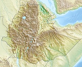
آتشفشان افدرا (به لاتین: Afdera) یک کوه در اتیوپی است که در منطقه اداری ۲ (عفر) واقع شدهاست.[۱] آتشفشان افدرا ۱٬۲۹۵ متر بالاتر از سطح دریا واقع شدهاست.
جستارهای وابسته
[ویرایش]منابع
[ویرایش]- ↑ مشارکتکنندگان ویکیپدیا. «Afdera (volcano)». در دانشنامهٔ ویکیپدیای انگلیسی.
پیوند به بیرون
[ویرایش]در ویکیانبار پروندههایی دربارهٔ آتشفشان افدرا موجود است.

