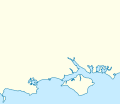
پرونده:England Southampton area location map.svg
ظاهر

حجم پیشنمایش PNG این SVG file:۱۷۰ × ۱۴۷ پیکسل کیفیتهای دیگر: ۲۷۸ × ۲۴۰ پیکسل | ۵۵۵ × ۴۸۰ پیکسل | ۸۸۸ × ۷۶۸ پیکسل | ۱٬۱۸۴ × ۱٬۰۲۴ پیکسل | ۲٬۳۶۹ × ۲٬۰۴۸ پیکسل.
پروندهٔ اصلی (پروندهٔ اسویجی، با ابعاد ۱۷۰ × ۱۴۷ پیکسل، اندازهٔ پرونده: ۳۸۳ کیلوبایت)
تاریخچهٔ پرونده
روی تاریخ/زمانها کلیک کنید تا نسخهٔ مربوط به آن هنگام را ببینید.
| تاریخ/زمان | بندانگشتی | ابعاد | کاربر | توضیح | |
|---|---|---|---|---|---|
| کنونی | ۳ اوت ۲۰۱۴، ساعت ۱۹:۱۹ |  | ۱۷۰ در ۱۴۷ (۳۸۳ کیلوبایت) | Mahahahaneapneap | Expanded |
| ۳ اوت ۲۰۱۴، ساعت ۱۸:۵۱ |  | ۱۶۰ در ۱۳۷ (۴۲۸ کیلوبایت) | Mahahahaneapneap | More space to the north | |
| ۲۲ سپتامبر ۲۰۱۳، ساعت ۰۱:۵۹ |  | ۱۶۰ در ۱۲۷ (۴۲۸ کیلوبایت) | Mahahahaneapneap | {{Information |Description ={{en|1=Map of Southern England Equirectangular projection, N/S stretching 170 %. Geographic limits of the map: * N: 51.326° N * S: 50.528° N * W: 2.339° W * E: 0.627° W}} |Source =[[:File:England location ma... |
کاربرد پرونده
صفحهٔ زیر از این تصویر استفاده میکند:
کاربرد سراسری پرونده
ویکیهای دیگر زیر از این پرونده استفاده میکنند:
- کاربرد در ar.wikipedia.org
- کاربرد در bs.wikipedia.org
- کاربرد در ceb.wikipedia.org
- کاربرد در en.wikipedia.org
- کاربرد در si.wikipedia.org
- کاربرد در war.wikipedia.org
