
پرونده:012 035 Ile Mingan Niapiscau.jpg
پروندهٔ اصلی (۲٬۶۹۸ × ۴٬۱۴۹ پیکسل، اندازهٔ پرونده: ۳٫۹۸ مگابایت، نوع MIME پرونده: image/jpeg)
این پرونده در ویکیانبار موجود است. محتویات صفحهٔ توصیف آن در زیر نمایش داده میشود. |
خلاصه
| توضیح |
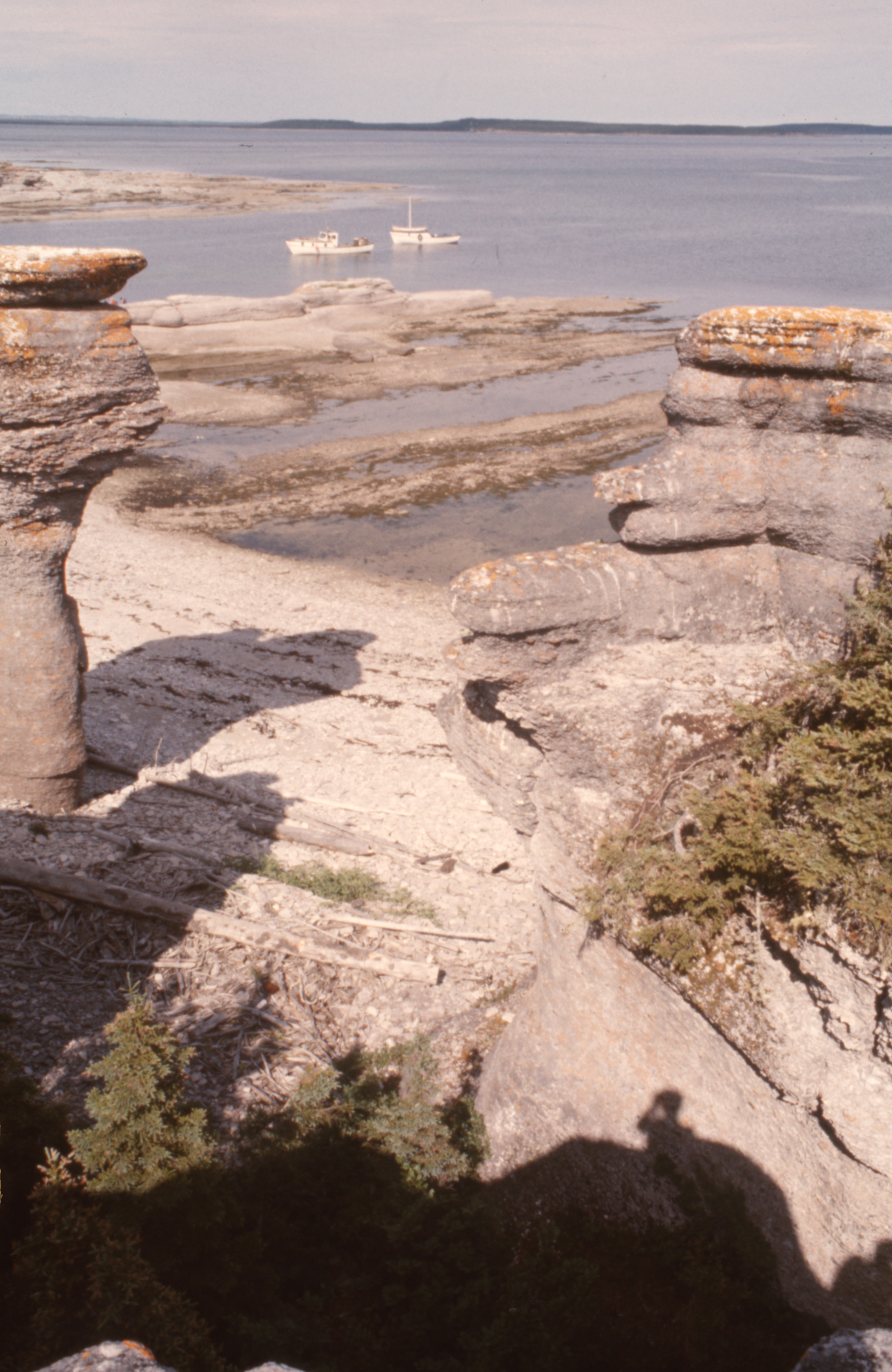
English: 50° 12' 10.0"N - -63° 28' 47.0"W, MRC Minganie, islands of the Mingan archipelago, limestone formations, boreal forest, Gulf of St. Lawrence, aboard the boat of Patrice Lebrun, guide and captain of the excursion, resident of Havre-Saint-Pierre and his family, Tuesday, July 20, 1976.
Français : 50° 12' 10.0"N - -63° 28' 47.0"O, MRC Minganie, îles de l'archipel de Mingan, formations calcaires, forêt boréale, golfe Saint-Laurent, à bord de la chaloupe de Patrice Lebrun, guide et capitaine de l’excursion, résident de Havre-Saint-Pierre et sa famille, le mardi 20 juillet 1976. |
| تاریخ | |
| منبع | اثر شخصی |
| پدیدآور | Nichole Ouellette |
| مختصات دوربین | | محل قرارگیری این نگاره و سایر نگارهها در: نقشهٔ شهری باز |
|---|
- More infos/photos, same author: ouellette001.com/
- Québec en photos – Réserve de parc national de l'Archipel-de-Mingan juillet 1976
- Golfe du Saint-Laurent, À bord de la chaloupe, bateau de plaisance
- Îles - îlots - rochers - cayes – récifs
- Îles - îlots - rochers - cayes – récifs
- Quarry, la mer, des îles
Excursion to the heritage site of the Mingan Archipelago, in a rowboat by Patrice Lebrun with his wife Hélène Turbis, his daughter Marilyne, his son Yvan, Guy Lapointe, our sons Jean-Bruno and Jean-Frédéric and me Nichole Ouellette The section of route 138 from Sept-Îles to Havre-Saint-Pierre opened in the spring of 1976. In July, we were among the first tourists to arrive by road, family, car and tent-trailer, the welcome was exceptional, a mixture of curiosity, hospitality, benevolence combined with a touch of incredulous distrust. We were amazed and won over by our contributor to this article
اجازهنامه
- شما اجازه دارید:
- برای به اشتراک گذاشتن – برای کپی، توزیع و انتقال اثر
- تلفیق کردن – برای انطباق اثر
- تحت شرایط زیر:
- انتساب – شما باید اعتبار مربوطه را به دست آورید، پیوندی به مجوز ارائه دهید و نشان دهید که آیا تغییرات ایجاد شدهاند یا خیر. شما ممکن است این کار را به هر روش منطقی انجام دهید، اما نه به هر شیوهای که پیشنهاد میکند که مجوزدهنده از شما یا استفادهتان حمایت کند.
تاریخچهٔ پرونده
روی تاریخ/زمانها کلیک کنید تا نسخهٔ مربوط به آن هنگام را ببینید.
| تاریخ/زمان | بندانگشتی | ابعاد | کاربر | توضیح | |
|---|---|---|---|---|---|
| کنونی | ۱۳ ژانویهٔ ۲۰۲۴، ساعت ۱۲:۴۰ | | ۲٬۶۹۸ در ۴٬۱۴۹ (۳٫۹۸ مگابایت) | Nichole Ouellette | Uploaded own work with UploadWizard |
کاربرد پرونده
صفحهٔ زیر از این تصویر استفاده میکند:
کاربرد سراسری پرونده
ویکیهای دیگر زیر از این پرونده استفاده میکنند:
- کاربرد در en.wikipedia.org
- کاربرد در fr.wikipedia.org
- کاربرد در ko.wikipedia.org